Pre-Funding Now Open: Offshore Equatorial Guinea Regional 2D Reprocessing Project
20 January 2026A New Window into EG's Frontier Potential
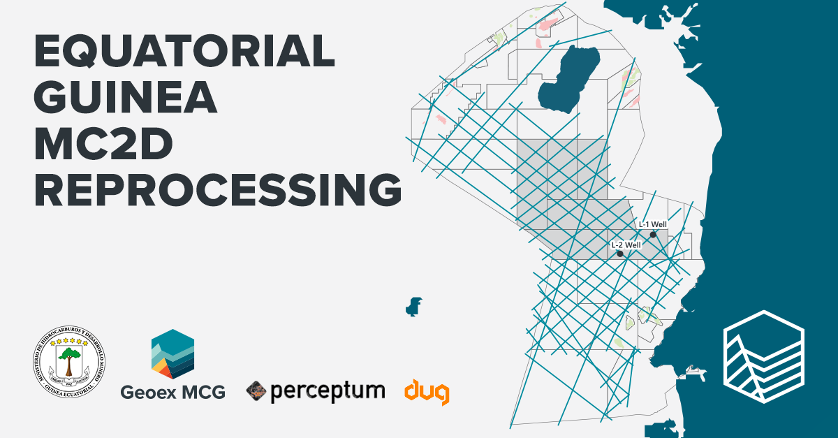
Geoex MCG, in partnership with the Ministry of Hydrocarbons and Mining Development (MHMD), Perceptum, and DUG, have launched a major reprocessing initiative to revitalise legacy offshore Equatorial Guinea regional 2D seismic dataset.
This project brings new geological clarity to one of West Africa’s least explored offshore regions, enabling operators to confidently assess opportunities across the central deepwater domain; an area historically lacking modern imaging.
Equatorial Guinea has a long and successful history of oil and gas exploration, with multiple key accumulations discovered across the basin. Yet despite decades of activity, the deeper structural framework and full extent of its petroleum systems remain underexplored, particularly in the central offshore domain.
With full support from MHMD, this project provides explorers with a modern, basin wide perspective that links producing margin wells to underexplored frontier areas.
Pre funding is now open to interested companies, please contact us.
Uncovering New Play Potential
The data is being reprocessed by DUG using cutting edge imaging technologies:
- PSDM workflows enhanced with FWI – advanced anisotropic model building
- Simultaneous reprocessing with our Rio Muni MC3D dataset for imaging consistency
- Integration of up to 36 producing and frontier wells to anchor the velocity model and improve interpretive confidence
The resulting PSDM dataset will offer significantly improved imaging of Miocene and Upper Cretaceous–Paleogene plays, fracture zones, deep structural trends, and potential migration pathways.
This uplift marks a step-change in the region’s interpretability and is positioned to become the definitive regional dataset for offshore EG.
Why This Project Matters to Explorers
1. Frontier potential with proven margins
Producing fields ring the offshore perimeter, but the central offshore remains largely untouched. This project ties wells to frontier areas (Multiple regional 2D’s), illuminating structures and trends previously masked by legacy data.
2. Evaluating source rock potential on oceanic crust
With industry interest rising in deepwater pceanic source rock plays, offshore EG offers a compelling opportunity. The new regional imaging provides the structural and depositional context necessary to evaluate this emerging frontier.
3. Cost-effective basin screening
Ideal for companies entering EG, preparing for licensing, or re evaluating their portfolios, this dataset enables rapid high value regional assessment.
4. Government alignment
With the Ministry as a direct partner, regulatory clarity, dataset access, and long-term project support are secured.
Who Should Participate
- New entrants to West Africa - Gain critical basin insight to support acreage strategies.
- Existing EG operators - Improve regional context, validate prospectivity, and uplift existing interpretations.
- Frontier exploration teams - Evaluate deep structures, source maturity, migration, and play potential at the basin scale.
Join the Project
Pre funding participants benefit from preferential commercial terms, early access to results, and strategic positioning for upcoming exploration decisions and licensing opportunities.
If your organisation is evaluating opportunities in Equatorial Guinea or wider West Africa, this dataset will be the cornerstone of your regional understanding.
To discuss participation or request commercial details, please contact:
Jean-Philippe Rossi
EVP, Geoex MCG
jp.rossi@geoexmcg.com