OFFSHORE MEXICO: MAXIMUS
21 October 2019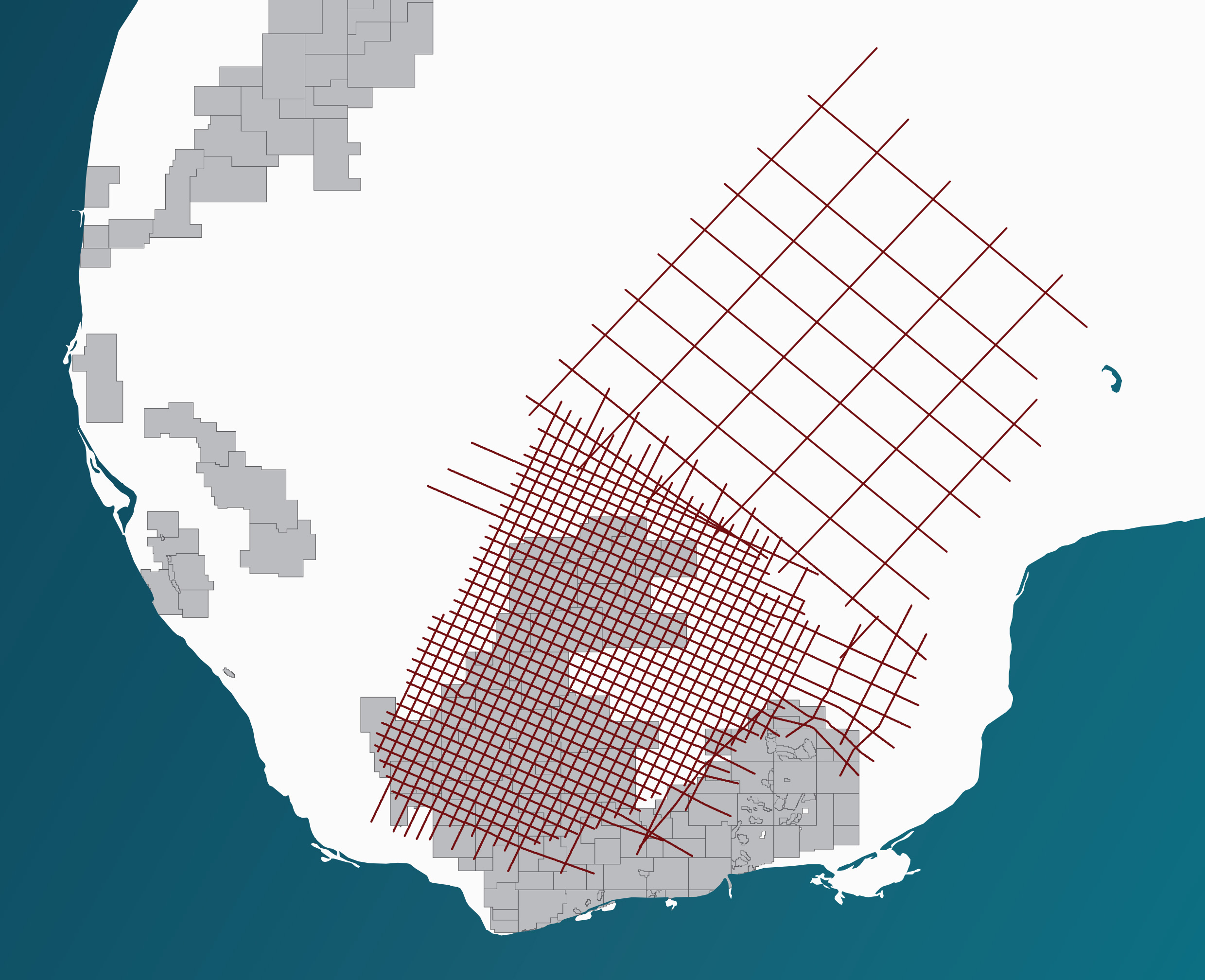

MAXIMUS. Right Data. Right Place. Right Time.
Maximus is a long offset deep record seismic survey covering the Campeche Salt Basin. The 23,612 km dataset provides high quality regional coverage.
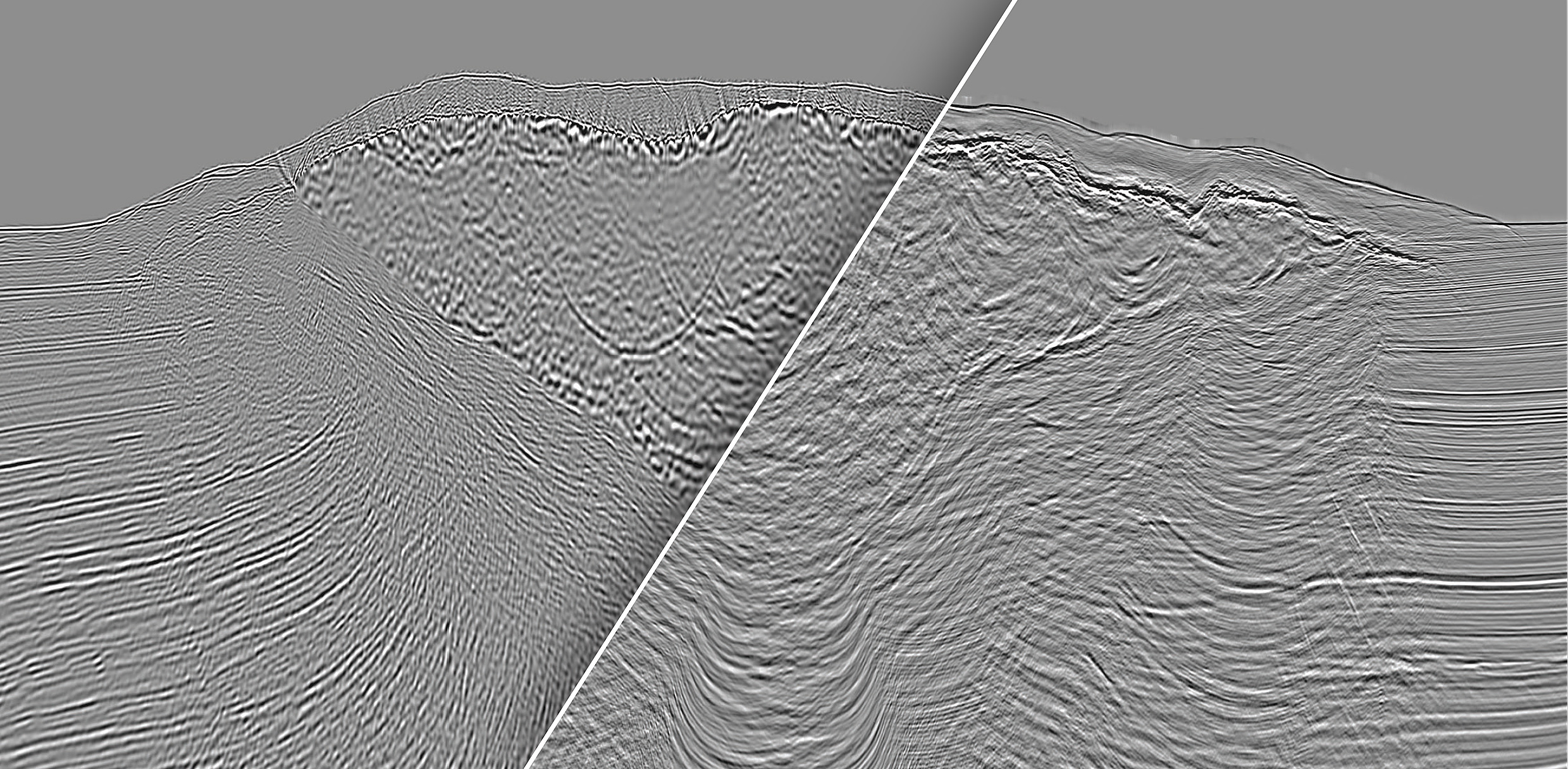
The dataset has now been further enhanced by Z-Terra and their integrated workflow using high level imaging technologies including Gaussian Beam Migration (GBM), FWI and Beam Tomography to assist interpreters. Final product is Reverse Time Migrated (RTM).
MAXIMUS. Right Data. Right Place. Right Time.
For more information about the Maximus project, please have a look at our two GEOExPro fold-out articles from 2016 and 2020:
Contact us today!
Tom Wolden
tom.wolden@mcg.no
Robert Sorley
robert.sorley@mcg.no