Evaluate Norway's APA 2025 acreage with the Quad 35 Hybrid MC3D and Regional Deep Imaging surveys
28 May 2025This highly prospective and historically prolific region of the North Sea has seen both legacy and recent exploration successes.
The available blocks are part of extensive regional 3D coverage and have been relinquished multiple times—making this the perfect moment for a fresh evaluation using the most advanced 3D data in this location.
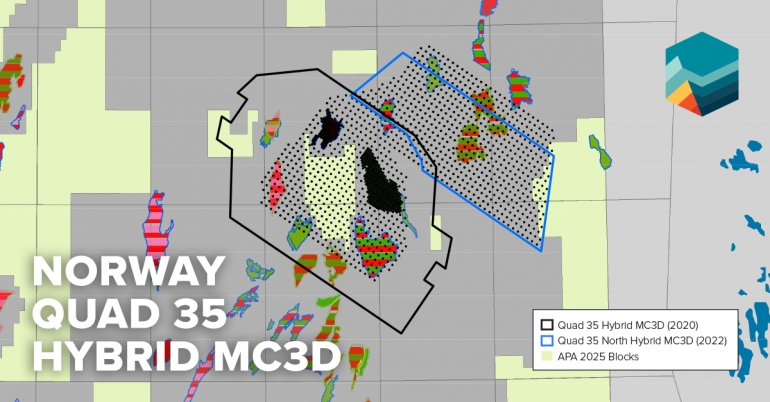
The Quad 35 Hybrid MC3D survey combines high-density streamer acquisition with Ocean Bottom Node (OBN) data, delivering exceptional pre- and post-stack imaging. With small bin sizes and high fold, this hybrid approach ensures superior resolution and clarity for detailed prospect mapping. In 2025, a selected area of the project was reprocessed using DUG's MP-FWI up to 60 Hz, focusing on enhancing the velocity model.
Read more about the Quad 35 Hybrid MC3D Projects
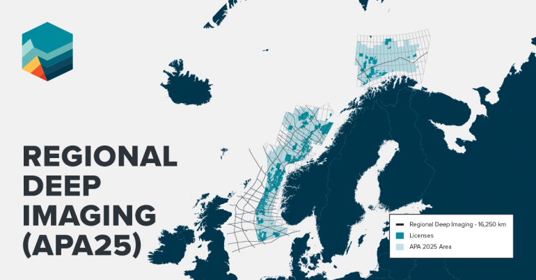
The Regional Deep Imaging (RDI) project delivers over 16,000 km of long-offset MC2D seismic across the North Sea, Norwegian Sea, and Barents Sea, imaging deep crustal structures with broadband acquisition, extended offsets, gravity and magnetic data, and cross-border coverage across Norway, the UK, Faroe Islands, and Denmark.
Read more about the RDI project
Contact our team to schedule a data viewing: