APA2019 Nordkapp Basin Reprocessing
04 June 2019The Nordkapp Basin
Sub Salt Exploration
The Nordkapp Basin makes up approximately 20% of the Norwegian continental shelf in the Barents Sea. Due to the problems of imaging below salt, exploration was halted in this area, even though the «Pandora» well proved hydrocarbons in the basin. MCG has in cooperation with PSS-Geo reprocessed a grid that comprise of approx. 20,000 km of NPD vintage 2D data (NPD-NOK1-86, NPD-FIØ1-86, NPD-FIØ2-86, NPD-NOLO-85 and NPD-FI-84) covering the Nordkapp Basin. The results are very promising.


The Nordkapp Basin Reprocessing Project
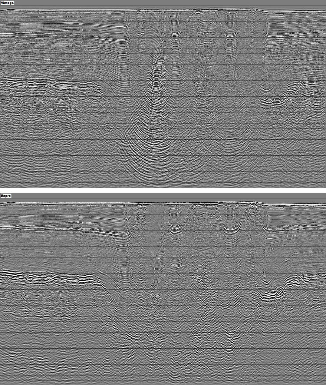
Noise removal is the major issue both in processing and interpreting the Nordkapp Basin
Diffracted multiples from Top Salt and edge of salt
- Steep dipping noise has high amplitude which makes it difficult to process and image real structures. PSS-Geo`s reprocessing manages to get rid of this noise efficiently and images steeply dipping flanks of salt domes.
De-multiple
- Original processing has a lot of ringing in the Triassic and below Top Permian. Our lastest de-multiple techniques help to clean the data much better in the deep.
Migration velocities
- All standard methods wastly overestimates the seismic velocities, so in our approach we are constructing our migration velocities based on logs
Deghosting
- Original processing has a peak at 25 Hz while de-ghosting is helping to broaden the amplitude spectrum. This make it possible to image deep structures and sub-salt structures where higher frequencies are attenuated very quickly
For more information about the Nordkapp Basin Reprocessing Project, please contact
Tor Åkermoen
tor.akermoen@mcg.no
(+47) 952 11 965
Lars Ivar Leivestad
lars.ivar.leivestad@mcg.no
(+47) 977 14 997